
Library Record
Images
Additional Images [40]
Metadata
Catalog Number |
2011.1.10 |
Object Name |
Book |
Summary |
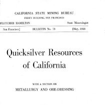
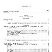
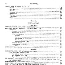
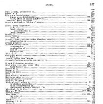
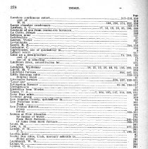
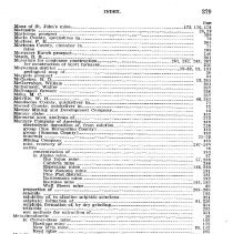
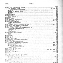
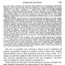
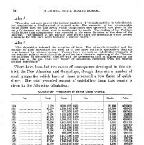
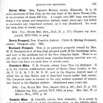
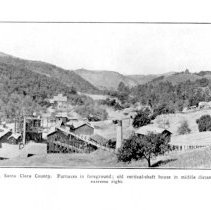
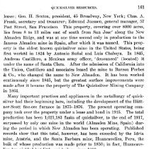
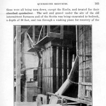
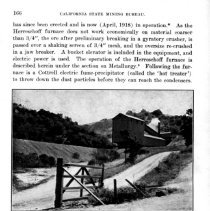
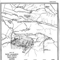
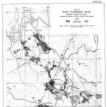
NOTE: There are two copies of this book CALIFORNIA STATE MINING BUREAU FERRY BUILDING, SAN FRANCISCO FLETCHER HAMILTON State Mineralogist San Francisco] BULLETIN No. 78 [May, 1918 Quicksilver Resources of California WITH A SECTION ON METALLURGY AND ORE-DRESSING By WALTER W. BRADLEY, E. M. CALIFORNIA STATE PRINTING OFFICESACRAMENTO 1918 CONTENTS. Page LETTER OF TRANSMITTAL 7 PREFACE 8 PART I, MINES AND GEOLOGY. CHAPTER 1. INTRODUCTION 9 USES 9 PRODUCTION AND PRICES 9 PRESENT ECONOMIC SITUATION 12 CHAPTER 2. GENERAL GEOLOGY OF THE DEPOSITS AND THEORIES OF ORE DEPOSITION 17 GEOGRAPHICAL DISTRIBUTION 17 GEOLOGIC FORMATIONS OF THE MIDDLE COAST RANGES 17 AGE OF THE ORE 18 THE FRANCISCAN GROUP 19 CHARACTER AND AGE OF EUROPEAN QUICKSILVER DEPOSITS 21 THE ORE DEPOSITION 21 FORM OF THE DEPOSITS 23 CHAPTER 3. MERCURY MINERALS 25 ASSOCIATED AND GANGUE MINERALS 28 CHAPTER 4, CALIFORNIA DISTRICTS 30 MINES AND PLANTS, ALPHABETICALLY BY COUNTIES 35 ALAMEDA 35 CALAVERAS 35 COLUSA 36 CONTRA COSTA 41 DEL NORTE 41 EL DORADO 42 FRESNO 43 GLENN 46 HUMBOLDT 46 INYO 46 KERN 47 KINGS 50 LAKE 52 LOS ANGELES 70 MARIN 70 MARIPOSA 71 MENDOCINO 71 MERCED 72 MODOC 72 MONO 72 MONTEREY 73 NAPA 76 NEVADA 92 ORANGE 92 SAN BENITO 93 SAN BERNARDINO 123 SAN FRANCISCO 124 SAN LUIS OBISPO 124 SAN MATEO 149 SANTA BARBARA 150 SANTA CLARA 154 SHASTA 168 SISKIYOU 169 SOLANO 171 SONOMA 181 STANISLAUS 197 TRINITY 200 TUOLUMNE 203 YOLO 204 PART Il. METALLURGY. CHAPTER I. INTRODUCTION AND ACKNOWLEDGMENTS 206 METALLURGY OF' MERCURY, OR QUICKSILVER 207 FURNACES 209 Retorts 210 Coarse-ore furnaces 220 Fine-ore furnaces 226 Losses 241 Costs 243 Percentage of extraction 245 Revolving furnaces 247 Multiple-hearth type 250 Drying the ore 254 Condensers 255 Soot 271 QUICKSILVER ASSAYS 277 CHAPTER 2. CONCENTRATION OF QUICKSILVER ORES 286 THE AUTHOR'S EXPERIMENTS 286 On tables, with water 294 By flotation, with oils 300 By solution, with an alkaline sulphide 321 PRACTICAL APPLICATIONS OF CONCENTRATION TO QUICKSILVER ORES IN CALIFORNIA 329 ESTIMATES OF CONCENTRATION COSTS 349 REDUCTION OF CONCENTRATES 350 ADVANTAGES OF THE ALKALINE SULPHIDE METHOD 351 CONCLUSIONS 352 PART 11I. BIBLIOGRAPHY ON QUICKSILVER. PART A: RE ASSAYS, CHEMISTRY, ORE-DRESSING, METALLURGY, ETC. 354 PART B: RE CALIFORNIAN OCCURRENCES ON GEOLOGY, MINERALOGY, AND MINE EQUIPMENTS 358 PUBLICATIONS OF CALIFORNIA STATE MINING BUREAU 363 INDEX 367 ILLUSTRATIONS. Photographs 1. A shipment of 300 flasks of quicksilver from the New IdrIa mine 10 2. Hot salino-sulphur water flowing from tunnel of Elgin mine 37 3. Furnace at New Mercy (Pacific) mine 44 4. Drawing off burned ore, New Mercy mine 45 5. Cuddeback cinnabar mine near Tehachapi 47 6. Micro-photograph of porphyritic rhyolite carrying cinnabar, from Cuddeback mine 48 7. Ten-ton Scott fine-ore furnace and condensers of Kings Quicksilver Mining Company, Ltd. 51 8. Retorts and condensers at the Big Injun mine 57 9. Fifty-ton Scott furnace at the Helen mine 60 10. Panoramic view of the Sulphur Bank mine 64 11. Exfoliation of basalt at Sulphur Bank mine 65 12. Hot springs in bottom of `Western Cut' at Sulphur Bank mine 66 13. Patriquin mine. near Parkfield 74 14. Bins and furnace plant at the AEtna 79 15. Furnaces at La Joya mine 85 16. Dumps of low-grade ore at Oat Hill 88 17. Serpentine surface near New Idria 94 18. Rotary furnace, Aurora mine 100 19. Old and new prospect tunnels, Florence Mack mine 104 20. Characteristic outcrops at Los Picachos Peak, Hernandez mine 106 21. Panoramic view of New Idria mine, plant and town 108 22. Flashlight view in square-set stope, New Idria mine 111 23. Ore trains at New Idria mine 113 24. New Idria mine, showing open cuts and dumps 114 25. San Carlos mine, open cut above No. 2 level 116 26. Blower and stack from fine-ore furnace, New Idria mine 118 27. Detail of tramway and ore-bin, Cambria mine 130 28. Old coarse-ore quicksilver furnace, erected 1873 at Keystone mine 134 28a. Klau mine, showing old stopes and drifts exposed by later, open-cut operations 136 29. Open cuts at Oceanic mine 141 30. Micro-photograph of diorite-gabbro at the Oceanic mine 142 31. Plant of Oceanic mine 143 32. Tramway unloading terminal at Oceanic mine 145 33. Open cut at Milburn-McAvoy (Los Prietos) mine 151 34. Guadalupe mine 158 35. Cottrell dust precipitator, or 'hot treater,' at Senator mine 165 35a. New 90-ton Scott furnace at Senator mine 166 36. St. John's mine, near Vallejo 177 37. Cloverdale mine 184 38. Great Eastern mine, near Guerneville 188 39. Socrates mine surface plant 194 40. Fifty-ton Scott furnace and condensers at Phoenix Mines 199 41. `D' retorts at .,Etna mine 212 42. Johnson-McKay retort, showing circulation system 213 43. Charging a Johnson-McKay retort at the Patriquin mine 214 44. A battery (12 pipes) of Johnson-McKay retorts at the Klau mine 215 45. Livingston furnace under construction at La Joya mine 216 46. Neate coarse-ore furnaces, at the Bella Union mine 223 47. Livermore furnace at Cloverdale mine 226 48. Ray electric oil-burners on Livermore furnace at Cloverdale mine 227 49. Side view of 50-ton Scott furnace at Oceanic mine 229 50. Quicksilver in earth and sand under site of old furnaces at New Almaden 242 51. Rotary ore-drier above Scott furnace at Socrates mine 247 52. New rotary quicksilver furnace at New Idria mine 248 53. Herreschoff multiple-hearth furnace at Senator mine 251 54. Top, or drying-hearth of Herreschoff furnace 252 55. Cottrell precipitator, or 'cold treater' at Senator mine 253 56. Scott furnace and condensers at Klau mine 254 57. Ore drier at St. John's 255 58. Condensers at New Mercy (Pacific) mine 257 59. Harrell condensers at New Idria mine 258 60. Round, wooden condensers at New Idria mine 259 61. Rectangular, wooden condenser and flue, at Oceanic mine 260 62. Condenser pipes of Johnson-McKay retorts at Patriquin mine 261 63. Condenser system on Johnson-McKay retorts at Sulphur Bank mine 262 64. Condensers and vitrified-pipe flues at "Etna mine 264 65. Condenser flues at New Idria mine 265 66. Cleaning up one of the new wooden condensers at New Idria 274 67. Soot mill at New Idria mine 275 68. Whitton quicksilver-assay apparatus, showing component parts 283 69. Whitton quicksilver-assay apparatus, assembled 284 70. Crushing and grinding floor in mill of Department of Mining, University of California, Berkeley 286 71. Hyde ('Slide') laboratory flotation machine 300 72. Case laboratory flotation machine 301 73. Froth on a flotation test with the Case machine 302 74. Neill jig, and New Standard table in plant of Oat Hill Leasing Company, Oat Hill mine 333 75. Gilpin County (Colorado) bumping tables in mill at AEtna mine 335 76. Flotation concentrates drying in the sun at the Senator mine 344 77. Gravel-washing plant for recovering metallic quicksilver from material excavated from old furnace sites at Hacienda of New Almaden Company 345 Plates (colored and line-cuts), I. Production and average price of quicksilver in California, 1850-1917 11 II. San Francisco quotations on quicksilver, January, 1914-March, 1918 12 III. Outline map of California, showing location of quicksilver deposits 17 IV. Color plate showing quicksilver ore specimens 25 V. Geological map of Mayacmas District 30 VI. Geological map of portions of Napa, Sonoma, Lake, and Yolo counties 32 VII. Geological map of Sulphur Creek District 33 VIII. Plan and elevation of Abbott mine 54 IX. Geological map and section of Sulphur Bank mine 66 X. Geological map of Corona mine 82 XI. Sketch of La Soya mine workings 84 XII. Geologic map of New Idria District 94 XIII. Geological map of Stayton District 96 XIV. Outline of orebody, New Idria mine 110 XV. Geological map of quicksilver districts in northwestern San Luis Obispo County 124 XVI. Map of Cambria mine workings 129 XVII. Map of Oceanic mine workings 142 XVIII. Geologic map of New Almaden District 154 XIX. Map of New Almaden 161 XX. Geologic map of St. John's mine 173 XXI. Map of underground workings, 160-foot level, St. John's mine 176 XXII. Map of underground workings, St. John's mIne 178 XXIII. Pipe retort furnace 211 XXIV. Plan of water-jet condenser for quicksilver retort at Oat Hill mine 211 XXV. Lander's continuous retort 218 XXVI. Exeli coarse-ore furnace 219 XXVII. Knox-Osborne coarse-ore furnace 221 XXVIII. Neate coarse-ore furnace 222 XXIX. New Idria coarse-ore furnace 224 XXX. Knox-Osborne fl ne-ore furnace 228 XXXI. Livermore furnace 230 XXXII. Plan of Hiittner-Scott furnace 231 XXX. Top of Huttner-Scott furnace 232 XXXIV. Discharge of Scott furnace 233 XXXV. Sketch of Scott furnace section 237 XXXVI. Chart showing condensation temperatures for mercury vapor in furnace gases 238 XXXVI-A. Revolving quicksilver furnace, New Idria type 248 XXXVI-B. Flow sheet of New Idria revolving furnace plant 249 XXXVII. Knox ironclad condenser 256 XXXVIII. Scott's brick condenser plant 263 XXXIX. Whitton quicksilver apparatus 281 XL. Plan and elevation of concentrating system, Manzanita mine 331 XLI. Riffle unit, Oat Hill mine 334 XLII. Sketch showing general flow-sheet of New Idria Quicksilver Mining Company, May, 1917 340 INDEX. SANTA CLARA COUNTY. The first known occurrence of quicksilver within the area of the United States, was that found at the New Almaden mine in Santa Clara County in 1824 by Antonio Sunol and Louis Chaboya. Though some occurrences had apparently been earlier noted in Mexico, the New Almaden was the first producing quicksilver mine in North America. Sunol and Chaboya built a mill nearby and endeavored to extract silver from the cinnabar. Late in 1845, the ore was shown to Andreas Castillero,) a Mexican officer, who identified it as cinnabar, and under whose direction development work was immediately begun. Gun barrels were utilized as their first retorts. The output was small, how-ever, until after California became part of the United States, since which time more than a million flasks have been produced in this county, as may be noted from the tabulation herewith, the greater portion of which came from the New Almaden mine.' The quicksilver deposits of Santa Clara County are confined, with one exception, to what is known as the New Almaden district (see Plate XVIII) . This district lies east of south from San Jose, extending from the northeasterly foothills of the Gabilan Range on the west to the low foothills that lie between Coyote and Dry Creeks on the east. It also embraces the Santa Teresa Hills. a low spur ridge which lies between and in general parallel to the other two. The principal deposits are 8 to 13 miles from San Jose, on the ridge which forms the southwestern boundary of the Santa Clara Valley at this place, having a general NW-SE direction, and locally called the New Almaden Ridge. The geology of this district and particularly of the New Almaden ridge and its orebodies has been described in considerable detail by various writers, especially by Becker" and by Forstner,' the latter of whom says: The three ridges in which the deposits occur are to a great extent formed by serpentine, especially the two first named. The serpentine is associated with metamorphic sandstone and jaspilites. Large bodies of croppings can be found in each of these ridges, having also a general northwestern trend, but not coinciding with the backbone of the ridges. "In the New Almaden ridge the most extensive orebodies have been found in and close to Mine Hill, the highest peak of the ridge, lying in its southeastern part. From this point going northwestward the croppings, while not continuous, can be traced along the ridge into the territory of the Guadalupe mine, a distance of about 3 1/2 miles. At the surface the serpentine shows in large detached bodies surrounded by the sandstones and shales of the Franciscan series and having a general northwestern trend. This general direction of the serpentine exposures is important in connection with its occurrence underground, proven in the New Almaden mine. The line of ore croppings runs from Mine Hill to the American shaft, passing about 600 feet south-west of the Randol shaft. The underground workings in this territory have shown 'Black's Supreme Court Reporter : The United States vs. Andreas Castillero : vol. 2, 1862. Also U. S. G. S., Mon. XIII, pp. 8-10, 1888. 'A portion of the data herewith relating to. the quicksilver mines of this county is taken from the manuscript of a report on the "Mines and MIneral Resources of Santa Clara, et al. counties" by Emile Huguenin : Cal. State Min. Bur., biennial period, 1917-1918, in preparation. This has been supplemented by later observations of the present author with particular reference to plant equipment. 'Becker, G. F., Geology of the quicksilver deposits of the Pacific Slope: U. S. Geol. Surv., Mon. XIII, pp. 310-330, 467, 1888. 'Forstner, Wm., Quicksilver resources of California: Cal. State MIn. Bur., Bull. 27, pp. 168-171, 1903. that the fissures wherein the orebodies have formed have invariably a serpentine footwall ; hence the serpentine must be considered to occur underground in a continuous body through this entire territory and to be in places covered by overlying sandstones and shales. Southwest of Capitancillos Creek lies another parallel exposure of serpentine, contiguous to which the outcrops of the Costello mines are found. The Santa Teresa and Bernal mines are located in the serpentine of the Santa Teresa hills, and the North Almaden or Silver Creek mine close to those of the most northern ridge. In the latter a great part of the serpentine is very highly altered by silicification, as also the sandstones, a great portion of the rocks being jaspilites. The western slope of the adjoining Mount Diablo range is nearly exclusively formed of shales. "In this district the occurrence of cinnabar-carrying orebodies is clearly closely allied to that of serpentine, and as the New Almaden was the first extensively worked quicksilver mine in California, this association explains the reason why, for a considerable lapse of time, cinnabar ores were, in the opinion of most quicksilver miners, considered related to this rock formation. The croppings consist of a more or less weathered material having usually an ochreous color from the oxidation products of the iron sulphides, and traversed by a network of quartz seams, from a knife blade to quarter of an inch wide. Overlying the ore bodies is almost invariably found a body of clay, generally black, and containing more or less inclusions of a dark-gray sand-stone. As this clay overlies the ore bodies it has received the name of 'alta' (Spanish for 'high' or 'upper'). At the surface this 'alta' crops as a light-gray material, resembling disintegrated sandstone, traversed by a network of very thin, yellowish-brown seams, often very much like a bunch of very fine roots. In places the same material can be found in the New Almaden mine several hundred feet below the surface, forming part of the 'alta.' * * The rocks of the Franciscan series in this region show a great amount of silicification. The chert beds are, however, almost entirely unrepresented. "To the west of the New Almaden ridge a belt of bedded sandstone is exposed. The beds are from 3 to 5 feet thick and interbedded with thinner beds of shale. * * * The country west of the New Almaden ridge and south of Capitancillos Creek. belonging to the Gabilan mountain system, consists almost exclusively of the sandstones and shales of the Franciscan series with occasionally some jaspilites. * * * West of the serpentine belt which lies west of the New Almaden ridge, south of Costello's house, a small exposure of glaucophane schist was found. A body of rhyolite lies in the northern part of the New Almaden ridge, having a nearly east and west strike and being about two miles long." The alta, or so-called clay referred to above, is not a substance of definite composition, though it is usually a dark or black mass, readily distinguishable even in hand specimens from the country rock. It is simply an attrition product of the country rock and varies in composition with the material from which it has been produced. Its black color is in part due to the presence of manganese. With reference to the age of the formations in the New Almaden district, Becker summarizes his observations in the following: "Upon highly metamorphosed rocks lie Miocene sandstones, which were sharply folded at the Post-Miocene upheaval. They are not conformable with the lower series and contain pebbles from these older beds. In the older rocks near New Almaden Mr. Gabb found Aucella, proving the presence of the Knoxville series. "In this district is the only mass of rhyolite thus far found in the Coast Ranges. It forms a dike nearly parallel to the line connecting the New Almaden and the Guadalupe. It is almost continuous, and I have followed it for a distance of several miles. It is certainly Post-Miocene and probably Post-Pliocene. "The New Almaden is a very extensive mine * * * The ore is cinnabar, with occasional traces of native quicksilver, accompanied by pyrite and marcasite, with rare crystals of chalcopyrite. The gangue is quartz, calcite, dolomite, and magnesite. These materials were deposited in shattered masses of pseudodiabase, pseudodiorite, serpentine, and sandstone. * * "The other mines of the district contain similar ores In similar rocks. The Guadalupe was the most productive. * * * "All the deposits of the district appear to occur along a rather simple fissure system. The main fissure is nearly parallel to the rhyolite dike at the Guadalupe. It follows the directIon of the hills, the axis of which curves gradually away from the dike for a certaIn distance. Passing through or near the San Antonio and Enriquita, it seems to break across the ridge at the America and enters the Almaden on the strike of its two great fissures. It is near this fissure that new orebodies are most likely to be found. The Washington seems to be on a branch of the main fissure. "This was probably formed at the time of the rhyolite eruption, to which also I ascribe the genesis of the ore." 50p. cit., p. 467. Also :# "This dike not only proves the former existence of volcanic activity in this district, but emphasizes a fundamental structural axis. The character of the metamorphic rocks shows that the line along which compression and upheaval took place in the early Cretaceous was about west by north, east by south. The folding of the Tertiary rocks shows that compression was repeated in the same direction at the close of the Miocene. The position of the rhyolite dike proves that the dislocation which opened a passage for this lava again followed a similar course." Also :% "Ore deposition followed the eruption of lava. The minerals deposited and the manner of their deposition are such as in the more northerly quicksilver districts were induced by volcanic springs. Though there are now no indubitable remnants of the volcanic activity which certainly prevailed here since the beginning of the Pliocene, the analogies of the deposit, together with the presence of lava of approximately the same age as the ore, make any theory of deposition excepting from hot sulphur springs improbable." There have been but two mines of consequence developed in this district, the New Almaden and Guadalupe, though there are a number of small properties which have at times produced a few flasks of quick-silver. The total recorded output of quicksilver from this county is given in the following tabulation: Quicksilver Production of Santa Clara County. Year Flasks Value Year Flasks Value 1850 7,723 $ 768,052 1885 21,400 $658,050 1851 27,779 1,859.248 1886 18,000 639,000 1852 15,901 927,505 1887 20,000 847,600 1853 22,284 1,235,648 1888 18,000 765,000 1854 30,004 1,663,722 1889 13,100 589,500 1855 29,142 1,560,554 1891 12,000 630,000 1856 27,138 1,401,678 1891 8,200 371,105 1857 28,204 1,374,381 1892 5,563 226,470 1858 25,761 1,232,149 1893 6,614 243,064 1859 1,294 81,690 1894 7,235 222,169 1860 7,061 378,117 1895 7.050 253,800 1861 34,429 1,447,739 1896 6,222 211,570 1862 39,671 1,442,041 1897 4,700 169,200 1863 32,803 1,380,350 1898 5,875 235,000 186-1 42,489 1,950,245 1899 4,435 186,270 1865 47,194 2,166,205 1900 5,145 241,073 1866 35,150 1,867,519 1901 5,220 236,608 1867 24,461 1,122,760 1902 5,869 254,260 1868 25,628 1,176,325 1903 5,603 233,130 1869 16,898 775,618 1904 +3,889 148,103 1870 14,423 827,592 1905 2.693 95,968 1871 18,568 1,171,641 1906 2,592 94,608 1872 18,574 1,224,584 1907 2,518 96,086 1873 11,042 887,004 1908 2,460 103,984 1874 9,084 995,455 1909 3,747 158,490 *20,000 *1,098,000 1910 4,038 182,719 1875 16,980 1,428,867 1911 7,533 346,593 1876 27,930 1,228,920 1912 8,695 365,538 1877 30,237 1,127,840 1913 3,709 149,213 1878 24,924 820,000 1914 2,407 118,063 1879 36,054 1,076,212 1915 4,386 376,319 1880 30,135 934,185 1916 4,016 375,496 1881 31,288 933,321 1917 5,921 639,594 1882 29,208 824,542 1883 29,084 836.165 Totals 1,127,380 $52,299,517 1884 20,000 610,000 *Estimated production of Guadalupe Mine previous to 1875. +Flasks of 75 pounds since June, 1904; of 761- pounds previously. #Idem, p. 314. %Idem, p. 328. Bernal Mine. Mrs. Ygnacio Bernal, owner, Edenvale. It is 10 miles southeast of San Jose, on the east slope of the Santa Teresa hills, at an elevation of about 450 feet. A tunnel, over 200' long, was driven along a clay gouge and serpentine contact, many years ago ; but failed to encounter any important orebody, so it was abandoned. No work has been done in recent years. Bibl.: CAL. STATE MIN. BUR., Bull. 27, p. 171; Chapter rep. bien. period, 1917-1918, in prep. Bowie Prospect, New Almaden district. Circle B. Mining Company, owner. Prospect only. Idle. Brainard Prospect. This is on patented property owned by Mrs. M. D. Brainard et al. of San Jose, situated south of the Guadalupe mine, and west of the northern end of the New Almaden lands. There is an old adit in which it is stated some cinnabar-bearing material was cut, but there has been no work done in recent years. Comstock Mine, T. H. French, owner, Lone Tree via Hollister. It is in the extreme southeastern corner of Santa Clara County, in Sec. 19, T. 11 S., R. 7 E., M. D. M., and in the Stayton district most of which lies in San Benito and is described herein under that county. The Comstock mine is located on the only surface exposure of serpentine found in the Stayton district. Abandoned some years ago. Bibl.: C. STATE MIN. BUR., Report XII, p. 367 ; Bull. 27, p. 172 ; Chapter rep. bien. period, 1917-1918, in prep. MIN. RES. W. OF ROCKY MTS., 1875, p. 14. Costello Mine. M. Costello, owner, New Almaden. It is about 11 miles by road southeast of the Guadalupe mine, on the hillside above Los Capitancillos Creek at an elevation of about 1000'. It is a prospect only and no ore was found in place. It has been idle for a number of years. Bibl.: CAL. STATE MIN. BUR., Bull. 27, p. 172; Chapter rep. bien. period, 1917-1918. Guadalupe Mine. New Guadalupe Mining Co., owner; Hugh C. Davey, president ; John L. Stubbs, vice-president ; Chas. W. Aby, treasurer; Route A, Los Gatos. This property, covering a territory of 2500 acres, is situated 10 miles south of San Jose on the west slope of New Almaden Ridge, and adjoins the land of the New Almaden company on the northwest. The mine was discovered in the early 5O's and is said to have produced 20,000 flasks "of quicksilver up to 1875, when it became the property of the Guadalupe Mining Company. This company erected furnaces and made many surface improvements. In 1886 the mine was shut down due to litigation, remaining idle until 1900 Photo No. 34.-Guadalupe Mine. Santa Clara County. Furnaces in foreground; old vertical shaft house in middle distance; main working incline shaft, extreme right. when H. C. Davey, one of the present owners, organized the Century Mining Company. The old furnaces were remodeled, the mine unwatered, and operations resumed, since which time it has been an important and continuous producer. The total recorded output has been 105,772 flasks to the end of 1917. The mine was first worked by a vertical shaft, 625' deep, sunk on the south side of, and near the bottom of Capitancillos or Guadalupe Creek. It was very difficult to keep the surface water out of this shaft during the wet seasons, and it was finally abandoned. A 700-foot incline, which is now the main working shaft, was then sunk on the opposite side of the creek on the dip of the vein (see Photo No. 34). It has 3 compartments down to 180' on the incline (where it connects with No. 1 Tunnel, whose portal is just above the creek bed), and 2 compartments below that. There are many miles of underground workings in the Guadalupe. Several shallow shafts and drifts have been driven on different outcrops about the property, but mining is now con-fined to the main workings. From the plan of the old workings, it appears that the orebody developed by the vertical shaft on the south side of the creek had a northwest strike and southwest dip. The second level, 300' below the collar of the vertical shaft, connects with the incline shaft on the opposite bank of the creek. From the sixth level (625') of the vertical shaft an incline winze was sunk from which the seventh, eighth and ninth levels were driven ; but ore was developed only on the seventh and eighth levels. The ore of the Guadalupe mine is similar in appearance to that of the north-end New Almaden ground, being in part at least a silicified serpentine with cinnabar. There is some associated pyrite. When visited by the writer in September, 1917, the bed of the creek was being replaced by a concrete flume, 740' long and 55' wide, with side walls 9' high, to carry the stream over the portions of the old mine beneath. There is a 1' high cross-wall every 100' to hold the gravel and protect the flume floor from excessive wear. With this improvement in service, it is intended to un-water and again open up the old workings. Electric power will be used. - Equipment includes electric hoists, air compressors and machine drills. The reduction plant consists of 2 coarse-ore furnaces of 18 toils capacity each, and 2 fine-ore furnaces of 30 tons capacity each, all oil-burning,` and modeled after the Davey patents. The ore is broken to cobble size and sorted by hand in the mine, the waste being partly used to fill old stopes. At the surface, the ore is screened, and then trammed by- mule-drawn trains to the fine and coarse-ore furnaces respectively. The fine ore is passed through a rotary drier, 29' long x 28" diam., lined with_ one row of fire-brick. and driven by a 3 h. p. electric motor at 2 r. p. m. The discharge is directly into the feed end of the fine-ore furnace, in a sealed compartment to prevent escape of any mercury vapors that might be present. A concentrating plant of 50 tons daily capacity was built, and started operating in February, 1917, handling material from the old mine dumps. Crushing is done in a ball mill with 20-mesh screen. After classification, the fine pulp goes to a Deister table, and the sand to two Wilfleys. The plant is driven by a 25 h. p. semi-Diesel oil engine. The concentrates are said to assay 8%_10% mercury, and are reduced in the fine-ore furnaces. In September, 1917, there were 75 men employed, 25 of whom were underground. BibL: CAL. STATE MIN. BUR., Reports, VIII, p. 542 ; XIII, p. 600; Bull. 27, p. 173; Chapter rep. bien. period, 1917-1918 in prep. MIN. RES. W. OF ROCKY MTS., 1875, p. 13; 1876; p. 20. U. S. G. S., Mon. XIII, p. 326. Hillsdale or San Juan Bautista Mine (one time called Chapman; also Chaboya). Elizabeth Kohrs, owner, Hillsdale via San Jose, R. F. D. It is about 2 miles southeast of San Jose on the east slope of the San Juan Bautista Hills, and within one-half mile of a street-car line. These hills, an isolated group, composed of metamorphic rocks, largely serpentine, rise to a height of only a few hundred feet above the valley, and are a northward continuation of the Santa Teresa Range. The mine is said to have been discovered in 1847 and worked to 1861 by Mexicans, subsequently becoming the property of a Mr. Chapman who worked it up to 1874. In the spring of 1871, production was at the rate of 30-40 flasks of quicksilver per month.' It lay idle from 1874 until 1892, when it was reopened by R. H. Harper of San Jose, and worked spasmodically in a small way up to 1907. In 1915, under the name of New Discovery Quicksilver Company, a lease and bond was taken and a few flasks of quicksilver produced; but little work was done underground, and the lease forfeited. R. H. Harper was recently reported to be negotiating for the purchase of the property. There are said to be over 4,000 feet of underground workings, but most of the tunnels are now inaccessible, being caved. The reduction plant consists of two 12-pipe retorts, evidently built in later years, as they are in good condition. Bibl.: CAL. STATE MIN. BUR., Report XIII, p. 600; Bull. 27, p. 174; Rep. bien. period, 1917-1918, in prep. GEOL. Surv. OF CAL., Geol. vol. 2, pp. 112-113. New Almaden Mine (originally Chaboya; then Santa Clara). The Quicksilver Mining Company, owner ; New Almaden Company, Inc., 'Goodyear, W. A., Report on examination of quIcksilver mines in California: Geol. Surv. of Cal., Geol. vol. 2, pp. 112-113. 1882. lessee ; Geo. II. Sexton, president, 45 Broadway, New York ; Chas. A. Frank, secretary and treasurer; Edmund Juessen, general manager, 57 Post Street, San Francisco. This property, covering over 8000 acres, lies from 8 to 13 miles east of south from San Jose' along the New Almaden Ridge, and was at one time second only in production to the famous Almaden mine in Spain, after which it was named. This property is the oldest known quicksilver mine in the United States, being first worked in 1824 by Antonio Sunol and Luis Chaboya. In 1845, Andreas Castillero, a Mexican army officer, `denounced' (located) it under the name of Santa Clara. After the admission of California into the Union, Castillero and associates leased the mine to Barron Forbes & Co.. who changed the name to New Almaden. It has been worked continuously since 1845, but the greatest surface improvements were made after it became the property of The Quicksilver Mining Company in 1864. Many important practices and appliances in the metallurgy of quick-silver had their beginning here, including the development of the Huttner-Scott fine-ore furnace in 1875-1876. The present operating company took over the property under a lease and bond in 1915. The total production has been 1,021,183 flasks of quicksilver, to the end of 1917, surpassed by only one mine in the world (Almaden Mine, Spain) during the period in which New Almaden has been operating. Published records show that this total, however, has been exceeded by the Idria mine. Austria, and the Santa Barbara mine, Huancavelica, Peru, the bulk of whose production was made prior to 1850; in fact, Huancavelica has yielded but little quicksilver since 1800. GEOLOGY AND MINE WORKINGS. The New Almaden property really contains three mines, all of which are located on the same mineral belt: the great New Almaden mine proper, the Enriquita, and the Senator or El Senador as the Mexicans named it (also referred to as the North Line Mine). A distance of nearly 4 miles separates the first and the last-named. The workings of the main New Almaden mine, cover a territory of about 21 square miles, which is exclusive of the Enriquita and Senator; and their greatest depth is 2450 feet below the top of Mine Hill, which is the datum point for all underground workings. The elevation of Mine Hill is 1600' above sea-level. In this territory 18 shafts have been sunk, and there are nearly 100 miles of underground excavations, much of which is at present inaccessible. Forstner states' that in 1903, the Victoria shaft, a short distance to the southwest of the Randol shaft, and the Harry shaft, on the southeast slope of Mine Hill (see Plate XIX) were the 'Forstner. Wm.. Quicksilver resources of California : Cal. State Min. Bur., Bull. 27, p. 1173854003 only two shafts then in operation. The deepest workings then being followed were on the 1000' level, as below 1300' the mine was filled with water. Since that time, most of the work has been done through the Harry shaft and the Day tunnel, and more recently at the Senatormine. Geology. The geology of the New Almaden mine has been studied and described in considerable detail by a number of authors, the most important of whom was Becker. He states: 'The ores * * * are composed of the usual association of mInerals : cinnabar (sometimes accompanied by a little native mercury), pyrite, quartz, calcite, and dolomite. and more or less closely associated masses of bituminous matter. Accompanying the deposits is a small amount of chalcedony or opal, usually black in color, but this substance is much less abundant here than the greater part of the northern mines. Dolomite is more prevalent as a gangue mineral here than in most quicksilver districts * 'I'. "The rocks associated with cinnabar in this district include every variety of the metamorphic series. Where the rock happens to be a permeable sandstone, impregnations have resulted. Elsewhere the ore seems to occur exclusively In crevices in the rock * * * I was unable to perceive any indication that ore had been deposited by substitution or that the rock had influenced the deposition of ore by its chemical properties. Ore is found with nearly equal frequency in contact with various rocks and the existence of fissures appears to have been the necessary and sufficient condition for the deposition of cinnabar and gangue minerals. * * * The ore in the New Almaden mine seems never to occur except close to evidences of faulting. This evidence consists in the presence of layers of attrition products, so-called clays, full of slickensides and of fragments of rocks more or less rounded by attrition. These layers of clay usually occur on the hanging side of deposits and are known to the miners as altas, the Spanish term for hanging-walls. The clays are impermeable to solutions and the ore usually forms on their lower side, as if the cinnabar had ascended and been arrested by the altas. * * * "While the evidence of the existence of a fissure system Is, if possible, more abundant in the New Almaden mine than In most quicksIlver deposits of the Pacific Slope, the deposits themselves are of various types. The commonest is the reticulated mass, or stockworks, consisting of Irregular bodies of broken rock into which solutions of cinnabar and gangue minerals have filtered, cementing the fragments together with ore. Where the disturbance has been less extensive and irregular. clean-cut fissures may sometimes be seen filled with ore, and these can only he classIfied as veins, though they are not persistent. * * * "Certain features must be common to the ore bodies taken singly and to the ore-bearing ground as a whole. It would be impossible to suppose that each stockwork has an independent fissure system, and a mere glance at the mine map shows that a connection between them exists. It is also a historical fact that the thin seams of ore * * * have led from one ore chamber to another. * * * "The distribution of serpentine, the average strike of the metamorphic strata, the compression of the Miocene beds, the position of the rhyolite dIke, and the trend of the range, In short the whole structural geology of the region shows that the fundamental axis of disturbance must have a direction which is approximately north-west and southeast." Also "Considered in detail, the ore bodies are stockworks ; but they are arranged along definite fissures and the deposits as a whole have a vein-like character and answer to the 'chambered veins2 defined in a subsequent paragraph. The workings have developed two main fissures. One of these dips from the surface at a high angle and in a nearly straight line. The other strikes in nearly the same direction as the first, dips steeply from the surface, then flattens and approaches the first fissure rapidly, again becomes very steep, and in the lowest workings almost coincides with the first. In vertical cross-section the two fissures form a figure resembling a V. The great ore bodies are distributed along these two fissures, making irregularly into the walls. The wedge between the fissures also contains ore bodies." Mine Hill Workings. The surface and workings of the New Almaden mine have been minutely surveyed and the data carefully preserved by the officers of the Quicksilver Mining Company in the form of a large, detailed, 2Becker, G. F., Quicksilver deposits of the Pacific Slope: U. S. Geol. Surv., Mon. XIII, pp. 314 et seq, 1888. Op. cit., p. 467. colored map which hangs in a specially-constructed fireproof draughting room, adjoining the office at the Hacienda. An excellent reproduction of this map, up to the date of its publication, 1888, accompanies Becker's report.' The map herewith (Plate XIX) was compiled from the company's records and is reproduced herewith by courtesy of Mr. Edmund Juessen, general manager. The principal clumps are shown in brown with the surface contour lines. The principal orebodies extracted since Becker's publication of the map, are indicated by: 1. The N-S line of stopes to the west of and nearest the Harry shaft. 2. The line of stopes lying approximately at right angles across the northwestern end of the older stopes, and extending south-westerly from the `mouth of Randol tunnel.' 3. Portions of the stopes south of the Cora Blanca shaft. The ore deposits are limited on their hanging-wall side by the alta, which being an impermeable layer prevented the passage of water circulation. According to Forstner, the footwall side is persistently serpentine, from which it is concluded that the serpentine, or rather the intrusive peridotite which has altered to serpentine, is the cause of the fracturing of the other rock strata. "The fracturing has taken place on both sides of the serpentine, which apparently can not be considered otherwise than as an intrusive body having uplifted the rocks of the Franciscan series. "The ore bodies form principally in those parts of the zones where the dip of the 'alta' is very flat * * ' The contact of the alta with the underlying vein filling, and where this is missing with the serpentine, is very tortuous in both directions, vertically and horizontally, so that in the gangways, which * * * follow this contact, it is an exception to find a straight line of any length. The stopes are locally called 'labores.' The material which fills the zones of fracturing and wherein in places cinnabar forms, is generally rather hard and siliceous, traversed by a network of seams of quartz and dolomite, showing repeated fissuring and filling containing some inclusions of serpentine, the cinnabar forming principally in connection with the seams. In places the vein-filling has more of an ochreous character, the matrix being more or less leached out, leaving only the network of seams intact. ' * "The general character of the vein-filling indicates that, as in most of the other quicksilver deposits in the State, the deposition of cinnabar has been associated with the process of silicification, which characterizes the alteration of the rocks of the Franciscan series, "The general direction of the seams in the vein-filling is not parallel to the line of contact with the alta. * In the upper workings the part nearest to the alta is seldom the richest, the cinnabar forming more plentifully at from 5' to 8' below the alta, while in the lower workings the richest ore is invariably close to the alta. "The contact between the alta and the vein-filling is very sharply marked, but there is a gradual change of the above-described vein-filling into the material of the serpentine foot-wall, the vein material gradually carrying more serpentine, until it has entirely changed into the latter. The hanging-wall is a shale, judging from surface exposures. Underground, no crosscut through the alta to the hanging-wall was seen." Recent work. When visited by the writer in September, 1P17, some ore was being broken in stopes connected with the Day tunnel, and which it was intended to burn in the coarse-ore furnaces at the Hacienda. Plans were being made to drive a connection on the 800' level, from the Santa Rosa drift near the main shaft, to Deep Gulch tunnel. This will permit of tramming around the hill to the Hacienda furnaces, a distance of about :} mile, or about one-half that now traveled for delivery from 'Op. cit., Atlas Sheet IX. 'Op. cit., p. 178. 164 CALIFORNIA STATE MINING BUREAU. the Day tunnel. Equipment at the mouth of the Day Tunnel includes an Ingersoll-Rand duplex compressor, 16"x14" and 10"x 14", driven by a 100 h. p. electric motor. Senator workings. The principal ore extraction of recent months has been from the Senator workings, which are, as already stated in a preceding paragraph, nearly 4 miles distant from Mine Hill. This ground adjoins that of the Guadalupe mine, they being on opposite sides of the same ridge. A new `shaft' (winze) is being sunk, on a 60ø incline, starting at 1300' in from the portal of the main adit. The collar of the old winze is at 1150' in. An electric hoist with 75 h. p. motor is used. The tunnel level is designated as the 260' level, and levels down to #5 have been established in the winze, with sinking nearing #6 level. Only a little sorting is done in the stops underground. The ore goIng to the furnaces is stated to vary from 0.2% to 1.0% mercury. The formations and orebodies in the Senator and Enriquita mines are in general similar to those at the southern end of the New Almaden belt, but no bonanza shoots have been found like the massive cinnabar bodies worked in the upper levels of Mine Hill. The Enriquita mine was opened up in 1859, and up to January 1, 1865, had yielded 10,571 flasks of quicksilver. It has not been worked in recent years. REDUCTION EQUIPMENT. A study of the development of practices and appliances in the metallurgy of quicksilver during the past 60 years shows the intimate relations of such developments to the history of operations at New Almaden. In the earlier operations, the intermittent form of furnace was utilized. These furnaces and their modus operandi are described in detail by Goodyear' who observed them working in 1871 at New Almaden, Knoxville, and New Idria. The most important item for which credit is due to the staff of the New Almaden mine was the development in 1875-1876, of the Hiittner-Scott fine-ore furnace (now generally referred to as the Scott), by H. J. Huttner, Robert Scott, and J. B. Randol. This furnace is described in detail elsewhere herein' under the section on Metallurgy. For some years, the furnace equipment at the Hacienda (the name given to the community grouped about the reduction plant) included two Exeli coarse-ore furnaces of 12 tons capacity each; two Scott furnaces for `granzita' (medium ore) of 36 tons and 18 tons capacity, respectively; and two Scott furnaces for `tierras' (fine ore) of 36 tons and 24 tons capacity. When visited by the writer in September, 1917, ',Goodyear, W. A., Examination of the quicksIlver mines of California: Geol. Surv. of Cal., Geol., vol. II, pp. 106, 119, 131-132, 1882. See pp. 231 et seq., post. these were all being torn down. except the Exelis. and treated for their absorbed quicksilver. The soil and gravel limier the site of the old intermittent furnaces and of the Scotts was being excavated to bedrock, a depth of 30 feet. and run through a washing plant for recovery of the Photo No. 3S. Cottrell Dust Precipitator, or 'Hot Treater2 (concrete chamber at left). and Condensers connected with Herreschoff Furnace, at Senator Mine of New Almaden Company, Santa Clara County. metallic quicksilver contained." An important yield of metal is being obtained front this material. At the Senator mine, in 1917, a Herreschoff multiple-hearth furnace, mechanically rabbled(. was handling the ore. A 90-ton Scott furnace 'Set p. 344. post. has since been erected and is now (April, 1918) in operation.* As the Herreschoff furnace does not work economically on material coarser than 3/4", the ore after preliminary breaking in a gyratory crusher, is passed over a shaking screen of 3/4" mesh, and the oversize re-crushed in a jaw breaker. A bucket elevator is included in the equipment, and electric power is used. The operation of the Herreschoff furnace is described herein under the section on Metallurgy.ø Following the fur-nave is a Cottrell electric fume-precipitator (called the `hot treater') to throw down the dust particles before they can reach the condensers. Photo No. 35a. New 90-ton Scott furnace at Senator Mine of New Almaden Company. The first condenser consists of 20 iron pipes 12" diam. x 12' long (see Photo No. 35) an arrangement patented by Landers'ø in 1916, then manager of the New Almaden company. Condensers #2, #3. and #4 are redwood-stave tanks. 12' diam. x 16' high. No. 2 can be seen at the right of the photograph. These tanks are cleaned out once a week. *Since the above copy was prepared, the writer has visited (June 10/18) this new plant which is a double, Scott fine-ore furnace built with 4 fireboxes, and is handling a minimum of 75 tons per day. though it has treated up to 96 tons per 24 hours. It is thus the largest Scott furnace at present in operation. The ore is crushed to pass a 2-inch ring; and iIs transported from the crusher bins, by an inclined belt-conveyor, discharging directly into the top of the furnace. (See Photo No. 35 A.) The side walls of the furnace are built up several feet above the level of the throat, thus giving an auxiliary ore-bin and providing an automatic furnace-feed. There are eight new condensing chambers connected with this furnace, arranged in a double row. The first chamber in each row is of concrete, and the other three are of tongue and groove redwood, built rectangular. A 3-foot redwood-stave flue was being put in to connect the last of this series of condensers to the first circular wooden condenser of the Herreschoff series. Crude oil is used for fuel. 'See pp. 250-253, post. "Landers, W. IL, The smelting of mercury ores: Eng. & Min. Jour., vol. 102. p. 634. Oct. 7. 1916. Between the condensers and the outlet stack is a second Cottrell fume-precipitator (called the `cold treater') to throw down any remaining mercury `mist' that may still be in the gas flow. It is stated that a little quicksilver is obtained in this cold treater. For the Cottrell electric precipitators, the incoming line current of 440 volts is trans-formed up to 50,000 volts for the `hot treater', and to 100,000 volts for the `cold treater'. During 1916 and a part of 1917, concentration plants including flotation units were in operation at the Day tunnel and at the Senator mine, but both had been dismantled just previous to the writer's visit in September, 1917. These plants are described in detail elsewhere herein," in the section under Metallurgy. There is little or no mining timber available in the vicinity of these mines. Sawed timber is brought in by the railroad from outside points. Fuel oil is used at the furnaces. In September, 1917, a total of 103 men were employed, including (i0 underground, and 6 at the Senator furnace plant. Bibl.: Note-The New Almaden mine and plant have been described by so many writers, that only the principal references are here given. Others will be found in the Bibliography in Part III, of this bulletin. CAL. STATE MIN. BUR., Reports I, pp. 26, 27; IV, pp. 336 et al; VIII, pp. 541-542; X, pp. 604-606; XI, pp. 374-375; XII, pp. 367-370; XIII, pp. 600-601; Bull. 27, pp. 174-186; Chapter rep. bien. period 1917-1918, in prep. U. S. G. S., Mon. XIII, pp. 8, 310-330, 467; Bull. 78, pp. 80-83; Min. Res. 1883-1915 inc. MIN. RES. W. OF ROCKY MTS., 1867, pp. 170-178; 1874, pp. 33, 380, 540; 1875, p. 13; 1876, pp. 4-18, 20. MIN. & SCI. PRESS, vol. 84, pp. 393-404, 1902; vol. 87, p. 201, 1903; vol. 100, pp, 15-16, 446-447; Feb. 16, 1916, pp. 282-284. ENG. & MIN. JOUR., vol. 34, pp. 185-186, 334, 1882; vol. 91, p. 85, 1911; vol. 102, p. 630, 1916. GEOL. SURV. OF CAL., Geol. vol. I, p. 68 ; vol. II, pp. 91-110, 122. Santa Teresa Mine. Enos Fontis, of Edenvale, owner. This property is 8 miles southeast of San Jose on the east slope of the Santa Teresa hills. It was developed by the Santa Teresa Quicksilver Mining Company, of which R. H. Harper of San Jose was superintendent. A 40-ton Scott furnace was erected, and several tunnels driven,- into the hill to cut the vein. The country rock is serpentine, and the ledge mat-ter an alteration product-of serpentine through silicification, carrying. a low percentage of cinnabar. After working a .few years,, without "See pp. 343-344, post. encountering any orebodies of sufficient size or richness to warrant their further exploitation, the mine was abandoned; and is. still idle. Bibl.: CAL. STATE MIN. BUR., Bull. 27, p. 186; Chapter rep. bien. period, 1917-1918, in prep. Silver Creek Mine (North Almaden). A. R. Bradford et al., owners, 770 E. St. John St., San Jose. This property, formerly, known as the North Almaden mine, is 12 miles by road southeast of San Jose, on the east side of Silver Creek. A large body of serpentine containing cinnabar was found in Silver Creek gulch, overlying Knoxville gravels. This detached body was evidently due to a great landslide which is plainly visible about the works. It was approximately 1000' in length, 300' wide, 60' in thickness, and was exhausted in a few years, producing about $60,000 worth of quicksilver. Occasional prospecting has been carried on since, but no important ledge has been found in place. The property is equipped with a 20-ton Scott furnace and a pipe retort. Bibl.: CAL. STATE MIN. BUR., Reports XII, p. 367; XIII, p. 600; Bul. 27, pp. 187, 235, 238; Chapter rep. bien. period, 1917-1918, in prep. Wright Mine. Mrs. A. Rodgers, owner, San Francisco. It is 3 miles south of the New Almaden Hacienda, on Llagas Creek, and is said to have produced some high-grade ore many years ago. It is hardly more than a prospect, and has had but little deevlopment work done on it. Idle. Bibl.: CAL. STATE MIN. BUR., Reports XII, p. 370; XIII, p. 600; Bull. 27, p. 187; Chapter rep. bien. period, 1917-1918, in prep. PLATE XVIII. MAP OF NEW ALMADEN MINING DISTRICT. SANTA CLARA CO. CALIFORNIA Accompanying State Mining Bureau Bulletin No.78 PLATE XIX. MAP OF NEW ALMADEN MINE SANTA CLARA CO., CAL. SHOWING PRINCIPAL STOPES, LEVEL, AND DUMPS |
Author |
Walter W. Bradley E. M. |
Title |
Quicksilver Resources of California Bulletin 78: with a section on Metallurgy and Ore Dressing |
Published Date |
1918 |